The View From Above

The last month and a half, our skies have been filled with smoke from too many forest fires.  The smoke on some days was so thick you couldn’t see down the road.  While it made for some unique sunrises and sunsets, and a few good pictures, it was sad.

The last couple weeks we’ve been feeling “fall” in the air.  This past week it was really starting to feel like fall with the change of the weather, our first freeze warnings, and a little bit of rain.

The blessing in the change of the seasons was in the higher country in the form of snow.  In my home state of Montana, they have lost over 1 million acres of beautiful forest land to forest fires.  I will not get into my opinion of why, because this is a happy blog.  They said the only thing that could help Montana put out the fires was snow.  Glorious snow.  We also got the snow in Oregon and rain in Washington state to help with the fires.

At work this past week, the clouds were just beautiful.  And we all know how I love clouds!  I thought it was a good thing I didn’t have my camera at work because I would want to be outside capturing the beauty.  So I waited.

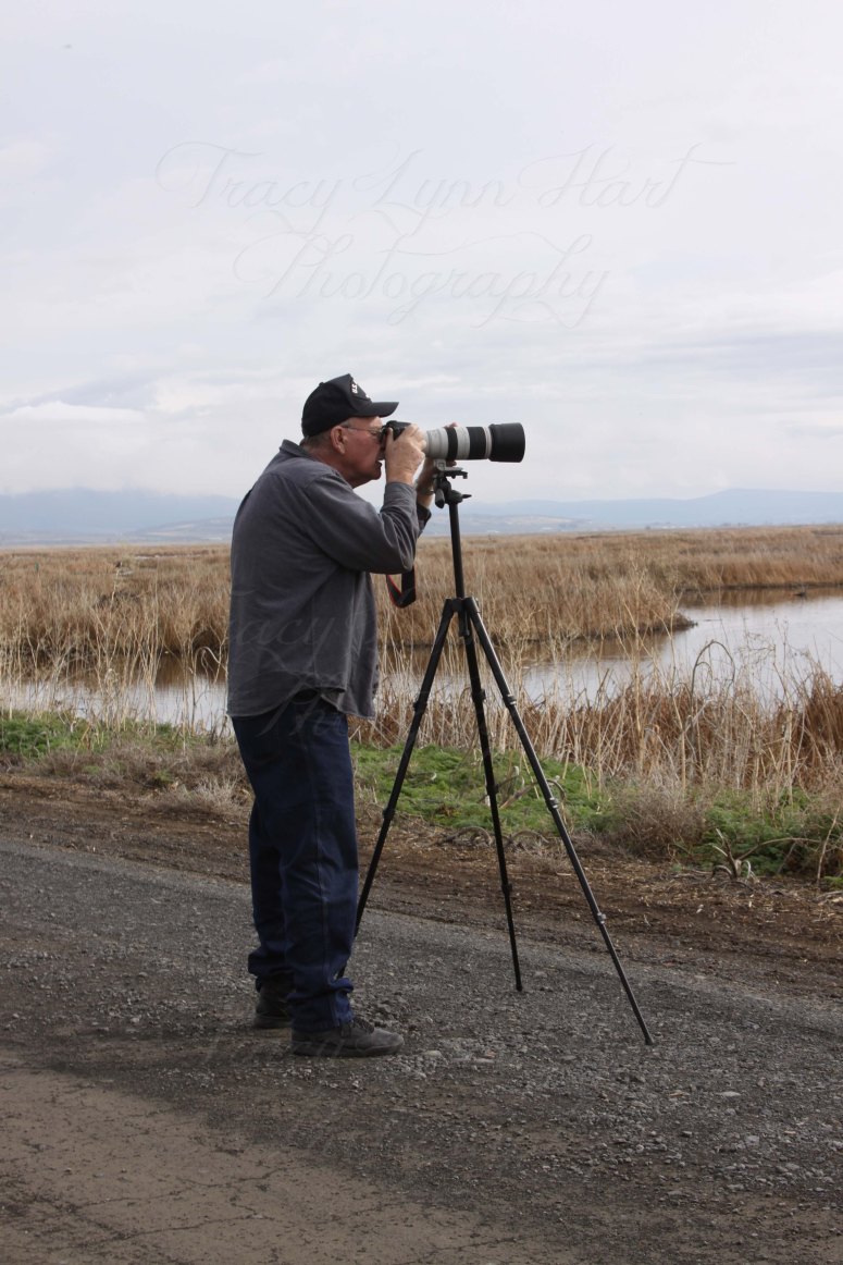
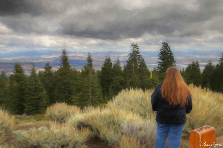
Friday morning (my day off) the Hubby and I went into town for breakfast and it was awesome to see white puffy clouds and clear blue skies. No smoke on the horizon.  We did some shopping and while we were in the stores, we came out and our puffy white clouds were gone and our skies were filled with white and gray clouds.   I think they were calling to me.  So we drove home to grab the cameras and go above it all.

To the top of a mountain called “Hamaker”

“1958-1979 A Cold War Air Force Radar Station was first established in Keno, Klamath County Oregon.  Named Keno Air Station”

To me, the above sentence is merely a “golf ball” on the top of Hamaker that we can see from our house.  But, there is history up on that mountain top.

Hamaker 11


Keno Air Force Station.  Established in 1958 and became operational in September 1958, manned by the 827th AC&W Squadron.  The station initially had both a Ground-Control Intercept (GCI) and early warning mission.  The early warning mission involved tracking and identifying all aircraft entering their airspace while the GCI mission involved guiding Air Force Interceptors to any identified enemy aircraft.  Controllers at the station vectored fighter aircraft at the correct course and speed to intercept enemy aircraft using vice commands via ground-to-air radio.

I could go on about the logistics and big words I didn’t understand in the article, but it is pretty interesting.  You can find more information here:

http://www.fortwiki.com/Keno_Air_force_Station

My story is this… It was a beautiful day in the Basin and the clouds were abundant and we were going to the top of that mounting to get some fresh air and beautiful views, and hopefully some pictures too.

It’s about and 8.5 mile drive to the top which is about 6500 feet. Don’t quote me on that, I was looking at the GPS on my phone.

We had been up here before when we first moved to the area.  I know it gets a lot of snow.  Hubby decided one day in March, to go on an adventure and travel to the top.  I am extremely glad I wasn’t with him. The last mile or so isn’t maintained.  It’s bad enough without the snow.

Hamaker snow 02

He made it back slowly to tell about it!

Once on top of Hamaker, you can look to the northwest and see Mt. McLoughlin, which you can also see from Medford on the other side of the Cascades.

Hamaker 06                                      Mt McLoughlin with a fresh blanket of snow!

You look out to the north, you see the Klamath Basin, farmland, Klamath Lake, Klamath River, and points beyond.  I truly love it up here.  Except it was 43 degrees and a light breeze.  Once the breeze quit, it was quite nice!

Hamaker 01

Hamaker 03

Hamaker 07

Hamaker 10

Hamaker 08

Hamaker 12

There is one thing for sure, that you can’t deny.  It is beautiful here every season.  (except fire season)

My advice is this;

If it’s the beginning of fall where you are, put on that hoodie or flannel shirt, pack the camera, maybe a picnic lunch, and go find your view from the top!  You won’t be sorry.  If it’s not feeling like fall, wait a couple weeks!  It might skip fall and go right into winter.  I say this because it almost always gets really cold or snows before Halloween!

Enjoy fall.  Enjoy the Pumpkin Spice everything.  Enjoy life.

Just a girl and her suitcase 01_01

Happy Shooting

Tracy Lynn


Explore and Experience Your Local Wildlife Refuge

When we first learned that we were moving to the Southern Pacific Northwest, we naturally started to research the area in which we were going to move to. The Klamath “Basin”, Klamath Falls Oregon.

One thing we have learned or I learned since I moved up here first, was this is not a valley.  Unlike Southern California, where you have San Fernando Valley, Simi Valley, Antelope Valley, etc … you get the picture. They’re all surrounded by mountains. So therefore it’s a valley.  I totally get that. I lived there for many years. Even in my home state of Montana, I lived in the Bitterroot Valley. But… Klamath Falls is the “Basin”
Here is the difference according to the search I did and we all know everything is true on the internet.

A basin is a depression or hollow on the earth’s surface, which is surrounded by higher land. A valley is also a depression or hollow between hills, mountains and uplands. A basin, which is also called a watershed, is the part of land that is drained by a river and its various tributaries.

So, I will go with the Basin idea, now that I know what the difference is. Kind of. It dates back to lots of history about the Klamath Watershed, and all the other shenanigans dealing with water in this area.

All that said, in doing the research of this area, it was learned that Klamath Falls is located on the “Pacific Flyway”

The Pacific Flyway is a major north-south flyway for migratory birds in America, extending from Alaska to Patagonia. Every year, migratory birds travel some or all of this distance both in spring and in fall, following food sources, heading to breeding grounds, or travelling to overwintering sites.

You can bet that once I learned that, I was all about what kinds of birds migrated to this area.

A large number of bald eagles winter in Bear Valley, located 10 miles (16 km) west of Klamath Falls, near Keno.

Yay!  Bald Eagles!  Last time I saw them in a large number was in 1981 when they followed the spawning habits of the Kokanee Salmon.  Which sadly, I learned a few years ago, they no longer converge on the waters of Glacier Park for this yearly event.

Eagle 04 Blog

Bear Valley, is close to where we live. It is part of the Klamath Basin National Wildlife Refuge Complex.

The complex consists of several refuges;

Lower Klamath National Wildlife Refuge    https://www.fws.gov/refuge/lower_klamath/

Tulelake National Wildlife Refuge    https://www.fws.gov/refuge/tule_lake/

Clearlake National Wildlife Refuge   https://www.fws.gov/refuge/clear_lake/

Upper Klamath Lake National Wildlife Refuge    https://www.fws.gov/klamathbasinrefuges/upperklamath/upperklamath.html

Bear Valley National Wildlife Refuge    https://www.fws.gov/refuge/bear_valley/

Klamath Marsh National Wildlife Refuge   hyperlink not available.

The Lower Klamath National Wildlife Refuge was  Established by President Theodore Roosevelt in 1908 as the Nation’s First Waterfowl Refuge.  

HAwk 01 blog

The Tulelake National Wildlife Refuge was Established in 1928 by President Calvin Coolidge “as a preserve and breeding ground for wild birds and animals“.

Clear Lake Refuge in northeastern California consists of approximately 20,000 acres of open water surrounded by over 26,000 acres of upland bunchgrass, low sagebrush, and juniper habitat. Small, rocky islands in the lake provide nesting sites for American white pelicans, double-crested cormorants, and other colonial nesting birds.  Clear Lake is not open to public access.

Upper Klamath Refuge was established in 1928 and is comprised of 15,000 acres of mostly freshwater marsh and open water. These habitats serve as excellent nesting and brood rearing areas for waterfowl and colonial nesting birds including American white pelican and several heron species. Bald eagle and osprey nest nearby and can sometimes be seen fishing in Refuge waters. A boat is a must for those who wish to explore this refuge. A marked canoe trail is open year round and canoes may be rented nearby. 

Bear Valley Refuge was established in 1978 to protect a vital night roost site for wintering bald eagles. The refuge consists of 4,200 acres, primarily of old growth ponderosa pine, incense cedar, white and Douglas fir.  Bear Valley National Wildlife Refuge also serves as a nesting habitat for several bald eagle pairs. Bear Valley is also closed to public access.

Now that you’ve had your history lesson….
As I mentioned I live near Bear Valley. It is an amazing sight to see Bald Eagles flying over the top of the house, either coming into the area or flying away from. Most likely they’re flying to the Lower Klamath Refuge which is about a ½ hour drive from where we live.
My husband and I are learning the roads in and out of the Lower Klamath Refuge.

Along the state-line highway (Oregon and California) you can make a turn onto the “Willows” road. This road is a line of willow trees that the Eagles nest in. Why they chose this row of trees I will never know. You can see Eagles, both Golden and Bald, Hawks and Owls in these trees. It is a really cool spot to photograph. The trees just by themselves without the awesome Eagles are interesting. They would make for some awesome scary tree collages in Photoshop. (another story for another time)willow for blog 01

This is really my “first” year photographing the birds in this area.  I mean, I’ve walked around Discovery Marsh, which is located at the Tulelake NWR, and have photographed Egrets, Pelicans and Ducks.  But these past few months have been about the Eagles and Hawks.

The beginning of February, we were able to see the Bald Eagles on Township road, which is a way I go to and from work, and we use it to come home from town.  Sometimes along our route to town or to breakfast in Malin, we would count Hawks and Eagles and our numbers would be in the 20’s  for hawks and the Teens for the Eagles.  Now that it’s nesting season, they aren’t around as much. I also imagine it has a lot to do with the farmers flooding the fields, so the mice and whatever hang out in the fields, have moved to higher ground.

Eagle 01 blog

On our weekly trek to Malin for breakfast, we pass the Willows Road and we wind through the Refuge on the gravel roads.

Where eagles nest blog

I have mentioned Malin Oregon before, but if I haven’t done so here, it is a farming community about 45 minutes from where we live.  My husband and I have been known to take a 6 hour round trip to and from Malin, via the way of the Refuge and Lava Beds National Monument.  All for the perfect “shot of the day”.   I never would have imagined we would spend such fun times most every weekend (weather depending) touring around. It’s awesome.  And I discovered that is makes sense to take two cameras out instead of one. We can both shoot to our hearts content.

Tlynn Shooting blog copy

Shooting blog

I was saddened when we were headed out one weekend day and were getting ready to turn down the “Willows” road and it was CLOSED

Eagle no parking 01blog

I totally understand though.  The eagles are nesting and the Refuge does this to reduce disturbances for the Eagles and other nesting birds.  I did so love that drive to see them all. In hopes of a great photo op!  The best were when the eagles were on the closer side of the road.

Eagle 09 blog

Bald and Goldens in Tree blog

If you haven’t experienced your local Wildlife Refuge, I encourage you to do so.  Take a little time away from the rat race of the city noise and your electronic devices,  find a refuge, or even a park,  just to unplug. Listen to the sounds of the nature.

Eagle and Shasta Blog

There is more to see on our  refuge than Eagles.  We have many migrating birds, Snow Geese, Tundra Swans,  Canada Geese, Greater White Fronted and lots of ducks. Right now the Coots are abundant and not so bright, but you can see  Northern Shovelers that look like a Mallard but they’re bills are black and shaped different, Buffleheads, Golden Eye, Ruddy Ducks, Pintail Ducks and a host of other ducks!  We were lucky enough to see Sandhill Cranes, a bit off the Refuge, but they are here as well. Soon we’ll have the White Pelicans, and other summer type birds, more Herons, Egrets, and Raptors.

Tundra Swans blog

Geese and Swans 02 blog

Golden 02 blog

Sandhill 01 blog

I am learning a lot more than I ever thought I would about birds.   It’s fun to ID a bird once you’ve seen it.  I am fortunate to work where most of the men hunt, so they can ID a duck or goose for me.

Shasta birds blog 01

I hope to visit a couple different Wildlife Refuges while the husband and I explore different areas this summer.

Even if you don’t have a camera, take a day trip.  Use your cell phone camera,  find a path to hike, a dirt road to drive down, something that gets you out of the house after a long winter!

Best of all.. Record your trips, and Have Fun.

The End Blog

Be Good Humans

T Lynn